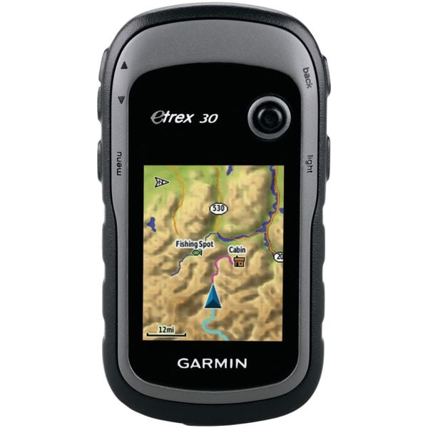
Garmin eTrex 30 GPS
- Unit dimensions, WxHxD: 2.1" x 4.0" x 1.3"
- Display size, WxH: 1.4" x 1.7"
- Display resolution, WxH: 176 x 220 pixels
- Display type: bright, transflective 65k color TFT, dual-orientation touchscreen; sunlight readable
- Weight: 5 oz (289 g) with included lithium-ion battery pack; 11.7 oz (333 g) with 3 AA batteries (not included)
- Battery:2 AA batteries (not included); NiMH or Lithium recommended
- Battery life: 25 Hours
- Waterproof:Yes (IPX7)
- Floats: No
- High-sensitivity receiver: Yes
- Preloaded maps: No
- Ability to add maps: Yes
- Built in memory: 1.7GB
- Accepts data cards: microSD
- Wapoints:2000
- Electronic compass: Yes
- Touchscreen: No
- Barometric altimeter: Yes
- Camera: No
- Manufacturer Warranty: 1 Year Materials/Workmanship Guarantee
- Manufacturer Item Number:569998
Garmin eTrex 30 takes one of the most popular and reliable GPS handhelds and makes it better. Enhanced ergonomics, an improved interface, paperless geocaching and expanded mapping capabilities makes eTrex more versatile and user-friendly, while maintaining its toughness and durability.
eTrex 30 has an enhanced 2.2", 65K color, sunlight-readable display. Durable and waterproof, eTrex 30 is built to withstand the elements. It has an upgraded interface and stands strong against dust, dirt, humidity or water.
eTrex 30 adds a built-in 3-axis tilt-compensated electronic compass, which shows your heading even when you’re standing still, without holding it level. Also added is a barometric altimeter which tracks changes in pressure to pinpoint your precise altitude, and you even can use it to plot barometric pressure over time, which can help you keep an eye on changing weather conditions.
With its microSD™ card slot and 1.7 GB of internal memory, eTrex 30 lets you load TOPO 24K maps and hit the trail, plug in BlueChart® g2 preloaded cards for a great day on the water or City Navigator NT map data for turn-by-turn routing on roads (see maps tab for compatible maps). eTrex 30 also supports BirdsEye Satellite Imagery (subscription required), that lets you download satellite images to your device and integrate them with your maps.