onXmaps Premium Google Earth Overlay Download Card
SKU
ONXM020
$40.00
Log in to earn points with purchase
Features
- * Not a stand alone product. Must first have a premium state specific GPS card, then purchase this Google Overlay download card to enhance your scouting planning at home
- Pinpoint private land owner names and property boundaries* so you can request access permission
- Discover little-known, seldom-hunted public land
- Gain an exact sense for terrain and boundaries
- Navigate confidently around private lands you're not allowed to hunt
- Quickly view Hunt Unit & Wildlife Managment Unit boundaries
- Easily identify changes in land ownership with straightforward color-coded parcels
- Access roads — (hwy, city, back-roads, trails, etc.)
- Discover water — (lakes, rivers, creeks, springs, etc.)
- Much more — every feature you will ever need in the field
- Manufacturer Number: HUNT-GOOG
Product Description
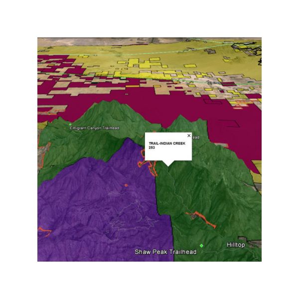
To aid in your at-home scouting, the HUNT for Google Earth map overlay integrates color-coded land ownership with 3D satellite technology. Go into 3D-view to see exactly where your public hunting land boundaries are and find smarter ways to access these areas. Query private land owner names and see property boundaries between private lands. HUNT for Google Earth by onXmaps is the most reliable source for your states land ownership maps on the market!
Hunt For Google Earth Features List:- Land owner name appears when you click the area of interest*
- Parcel boundary lines
- State specific
- Color-coded land ownership data
- National Park Service
- US Forest Service/National Grasslands
- US Fish & Wildlife
- State Land
- State Parks
- WMA, WPA, NWR, etc.
- Bureau of Indian Affairs
- DOD — COE - US Gov
- Local Government
- Hunt Unit & Wildlife Management Unit boundaries
- National Forest roads, trails, and Recreation Sites
- Section lines
- Much More!
Video - onXmaps Premium Google Earth Overlay
Related Products